Projects:
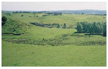
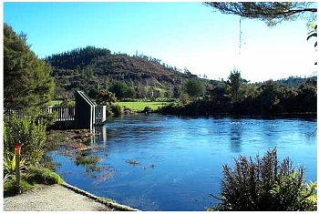
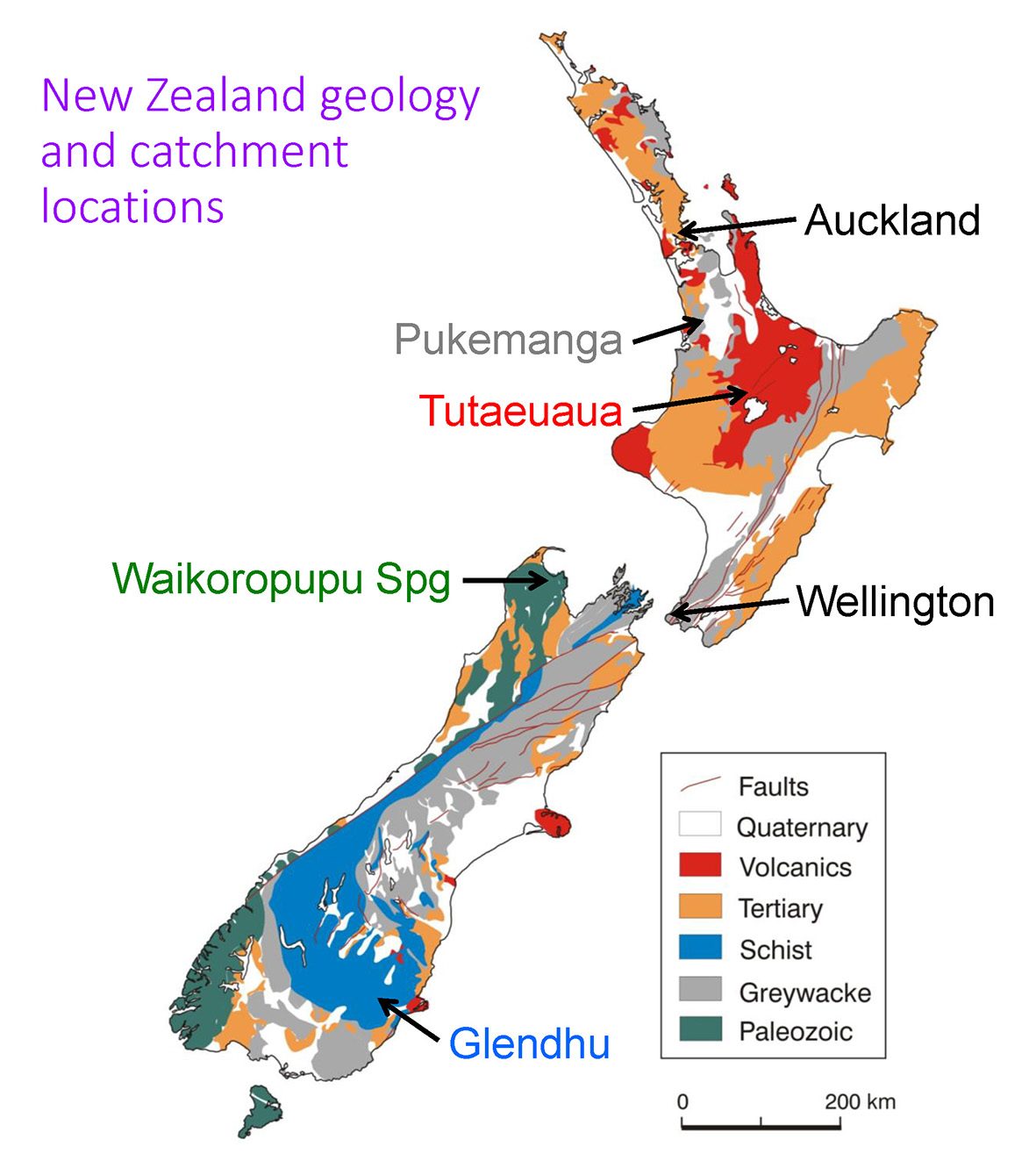
Tutaeuaua Catchment is a small (13 km2) catchment in a 1000 km2 area of young, ash-fall volcanic rocks, which drains into Lake Taupo (see location map at bottom). The rocks have unusual hydrological properties, which are revealed by the streams’ very long mean catchment transit times (40-84 years). The aim of the project is to investigate the flow of water and nitrogen in this small subcatchment as a sample of the larger area.
The topography is rolling to steep.
Seepage areas (wetlands) occur between adjacent hills.
The conceptual model is based on the dominance of deep groundwater flow in generating seepage and streamflow.
(Reference: Stewart et al. 2008, in preparation.)
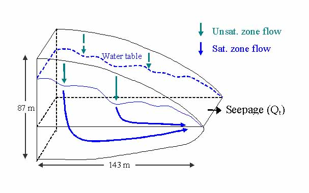
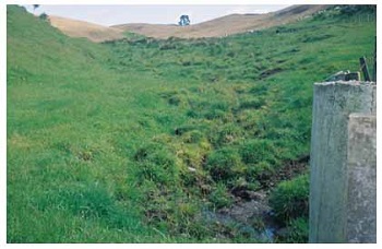
Pukemanga Catchment is on deeply weathered greywacke west of Hamilton (see location map). It is very small (3 ha) and has very steep slopes (up to 60o).
The perennial stream flows out of the 60 m2 wetland at the bottom of the gully.
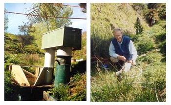
The mean transit time of water in the catchment is estimated to be 9 years, leading to the conceptual model below.
(Reference: Stewart et al. (2007), HP 21, 3340-3357.)
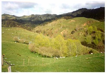
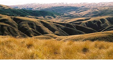
Glendhu Catchments are on weathered schist overlain by loess 60 km west of Dunedin in the South Island (see map below).
The topography is rolling to steep and elevation about 600 masl. The dominant vegetation is snow tussock.
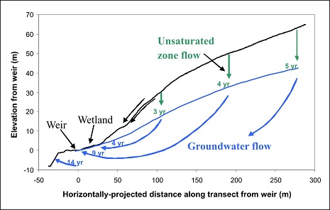
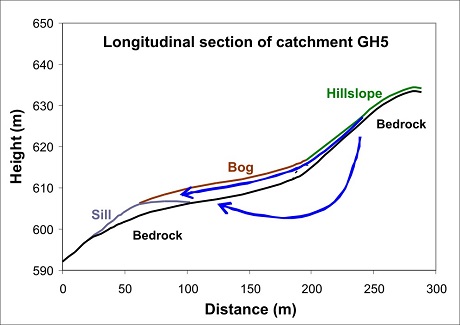
One of the study catchments, GH5 (3.64 ha), has a central 0.39 ha wetland from which a perennial stream emerges.
Tritium measurements show that the water flowing out of the wetland comprises 60% deep wetland water (mean age 27 years) and 40% young water (age < 1 year).
A conceptual model of the flows is given below.
(Reference: Stewart and Fahey (2010), HESS 14,1021-1032.)
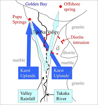
Waikoropupu Springs, the largest springs in New Zealand at 13.3 m3/s, arise from Arthur Marble in the Takaka Valley (see map).
The springs were found to be fed by two water systems, a deep system (with mean age of 10.2 years) and a shallow system (mean age 1.2 years).
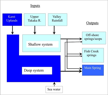
The deep system is fed by the karst uplands on each side of the Takaka Valley, and the shallow system by rainfall and Takaka River seepage within the valley.
(Reference: Stewart &Thomas (2008), HESS 12, 1-19.)
Locations of the catchments and simplified geology of New Zealand.
|